File:Wydmoor WIP.png
Jump to navigation
Jump to search

Size of this preview: 800 × 533 pixels. Other resolutions: 2,560 × 1,707 pixels | 3,600 × 2,400 pixels.
Original file (3,600 × 2,400 pixels, file size: 2.13 MB, MIME type: image/png)
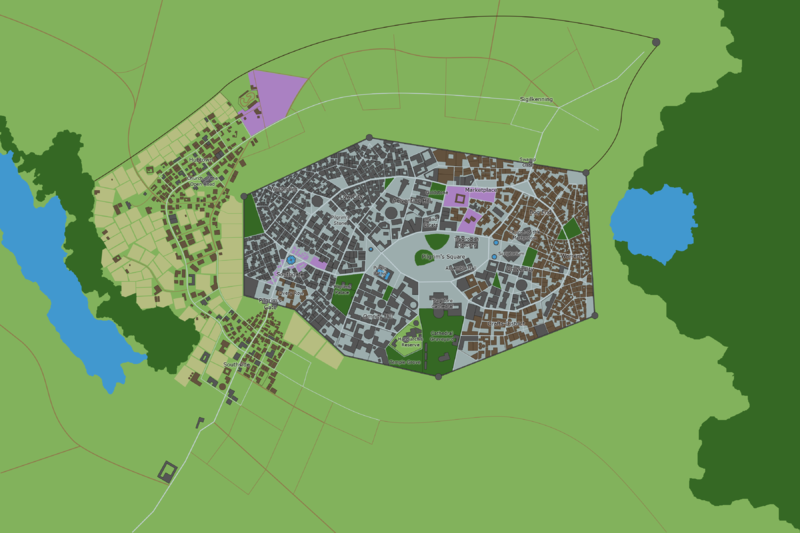
- Heritage map circa 1399
- Heritage map circa 1401
- Maps with some proof-of-concept buildings and social class of neighborhoods mapped
- Place labels and some civic buildings added
Population estimates:
| Social group | People per Buildings | Buildings per Block | Blocks | Total |
|---|---|---|---|---|
| Poor | 15 | 25 | 70 | 26250 |
| Middle class | 12 | 12 | 40 | 5760 |
| Wealthy | 10 | 7 | 20 | 1400 |
| Total | 33410 |
1.1 square miles
File history
Click on a date/time to view the file as it appeared at that time.
| Date/Time | Thumbnail | Dimensions | User | Comment | |
|---|---|---|---|---|---|
| 15:45, 16 March 2020 |  | 1,977 × 1,321 (924 KB) | Msallen (talk | contribs) | ||
| 15:37, 14 July 2019 |  | 1,812 × 1,146 (840 KB) | Msallen (talk | contribs) | ||
| 22:04, 13 October 2018 |  | 2,310 × 1,388 (688 KB) | Msallen (talk | contribs) | ||
| 15:27, 13 October 2018 |  | 2,310 × 1,388 (563 KB) | Msallen (talk | contribs) | ||
| 15:23, 13 October 2018 |  | 2,310 × 1,388 (2.66 MB) | Msallen (talk | contribs) | ||
| 15:22, 13 October 2018 |  | 2,310 × 1,388 (2.79 MB) | Msallen (talk | contribs) | Work in progress map for the new Wydmoor city. Versions 1 and 2 are the current map frame overlayed on two versions of the AR map from 1399 and 1401. I have another from 1402 but it doesn't really add information. I think the 1401 was a lost map redo b... |
You cannot overwrite this file.
File usage
The following 2 pages use this file:
- Wydmoor City
- File:Wydmoor-wip-1399.png (file redirect)